Weekly Weather Outlook and Update: February 8, 2024
Light precipitation possible through Saturday
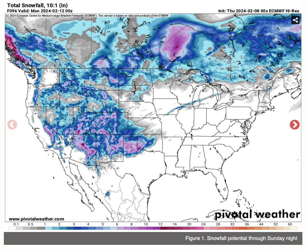
We have had a windy few days across most of the state and temperatures are dropping back closer to seasonal levels. Most of the next week will be quiet and dry with temperatures generally a bit above seasonal normals. But we do have a few chances across sections of the state in the next 48 hours. First, a shortwave will be moving across the southern half of the state tomorrow and that will bring chances of rain to areas along and south of the Platte. Rainfall amounts are not expected to be significant, with a 0.25" possible in parts of southwestern and south central Nebraska tomorrow afternoon and between 0.10-0.25" possible further east during the evening hours.
Then on Saturday, upslope flow from an area of low pressure to the south will allow for a period of light snow in the Panhandle, particularly between Sidney and the Wyoming border. Significant amounts of snow are unlikely- 4" maximum in the highest elevations of Kimball County- but be prepared for snow if you are traveling through that part of the state on Saturday. After Saturday, it appears that we have a quiet week in terms of precipitation at the moment, but I can't rule out a period of light snow between Thursday night and Friday afternoon across the northern and eastern thirds of the state week with an Alberta Clipper type system rolling into the region later next week.
Online Beef Cattle Production
Master of Applied Science
Develop an understanding of beef production as a system and be exposed to alternative production practices that may enhance profitability and stewardship.